
Transform Your Structural Analysis
with Advanced
3D Laser Scanning Technology
Transform Your Structural Analysis
with Advanced
3D Laser Scanning Technology
Get precise digital documentation without project delays or costly traditional surveys.
Smart technology for informed decision.
Trusted contractor for:
What is 3D Laser Scanning?
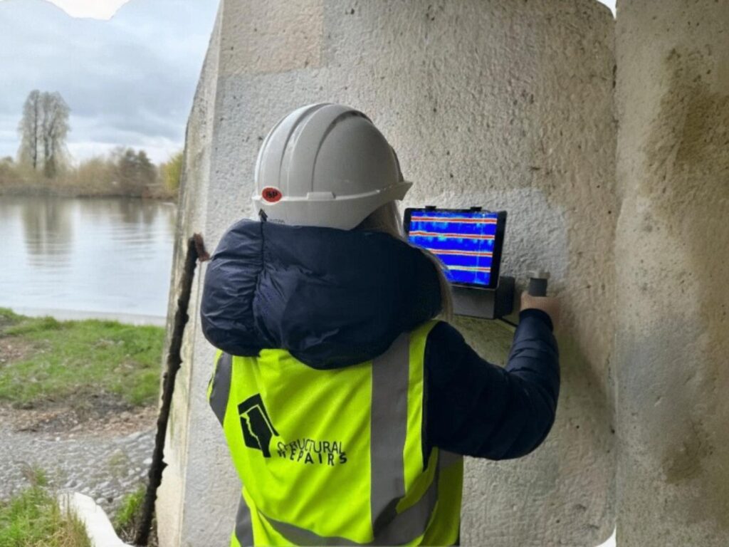
Understanding Laser Scanning
3D laser scanning is an advanced non-intrusive method that captures the exact dimensions and intricate details of structures with extraordinary accuracy. Utilising cutting-edge technologies like LIDAR mobile laser scanning device we can create a comprehensive 3D record that ensures every hidden defect and structural component is documented with unmatched precision. This level of detail provides a reliable foundation for assessments, enabling informed decisions for maintenance, repair, and long-term preservation.
Key functions:
#1
Create Digital Documentation:
Capture precise 3D models of buildings and structures with millimetre accuracy.
#2
Track Construction Progress:
Monitor and document site developments while comparing as-built conditions to design plans.
#3
Detect Structural Issues:
Identify potential problems early, from misalignments to structural deformations.
#4
Generate Accurate Measurements:
Obtain precise dimensional data for planning, retrofitting, and renovation projects.
#5
Support BIM Integration:
Create detailed point clouds for accurate Building Information Modeling implementation.
#6
Enable Virtual Planning:
Facilitate remote collaboration and decision-making through detailed 3D visualizations of project sites.
NOT just ‘another’ scanning service
We DON’T rely on basic surveys methods... we use deliver precise 3D reality capture.
Modern
solutions:
Our 3D
scanning experts utilise
state-of-the-art LIDAR technology to create
comprehensive digital twins.
Our 3D
scanning experts utilise
state-of-the-art LIDAR technology to create
comprehensive digital twins.

Get precision,
not approximations:
Millimetre-accurate documentation is crucial for informed decision-making in construction and engineering projects.
Millimetre-accurate documentation is crucial for informed decision-making in construction and engineering projects.

Join our
industry leaders:
We partner with major construction firms, heritage organisations, and infrastructure developers to deliver unmatched scanning accuracy.
We partner with major construction firms, heritage organisations, and infrastructure developers to deliver unmatched scanning accuracy.
Why Choose Us for 3D Scanning?
Scan-to-Solution Approach
We don’t just scan – we provide a comprehensive service from initial scanning through analysis to repairs and final verification, ensuring a complete structural health assessment.
Industry-Leading Technology
Our advanced non-intrusive scanning technology detects hidden defects and analyses concrete structures with unmatched precision, preventing unexpected costly repairs.
Proven Track Record
Trusted by major organizations like IHG, Network Rail, and Thames Water, we bring 35+ years of combined expertise in structural analysis and concrete maintenance.
Proactive Maintenance Planning
Our scan-report-repair-rescan methodology helps extend your structure’s lifespan through planned maintenance, reducing unexpected repairs and long-term costs.
Understanding 3D Laser
Scanning Capabilities
Our 3D Scanning Services can detect:
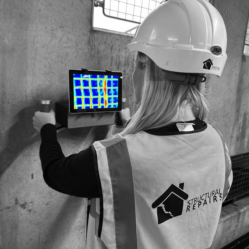

Advanced Data Capture: Captures 2,600,000 points per second with millimetre accuracy for mobile and stationary scanning.

Comprehensive Coverage: 120-metre range with 360° panoramic imaging for complete structural documentation.

Versatile Applications: Adaptable for construction tracking, BIM modeling, and diverse indoor/outdoor projects.

Precision When It Matters: 2mm accuracy (stationary) and 5mm accuracy (mobile) for precise structural detail capture.
Let’s protect your structure’s future – Contact us today for a consultation.
Why 3D
scanning is Essential?
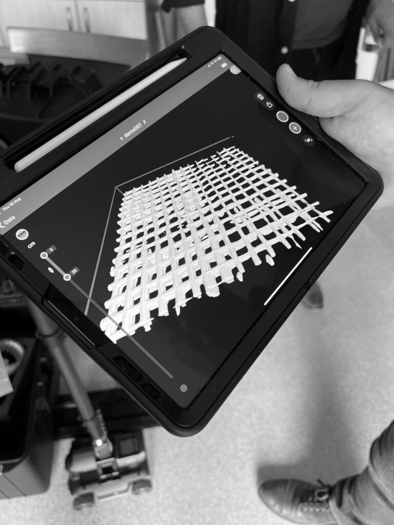
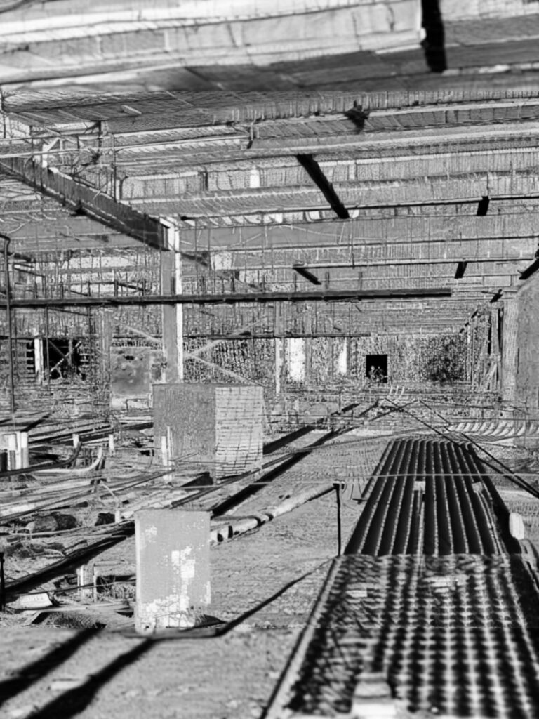
For Infrastructure Management: High-speed LIDAR scanning enables comprehensive digital mapping while minimizing disruption. With 2,600,000 points per second capture rate, it’s perfect for complex infrastructure assessment.
For Cost-Effective Solutions: Reduces manpower requirements and site visits compared to conventional methods, delivering significant time and cost savings with superior accuracy.
For Quality Assurance: Creates high-resolution 3D point clouds for engineering design with accuracy up to 2mm, ensuring precise documentation of every structural detail.
For Comprehensive Analysis: Complete 360° coverage captures all structural data, enabling thorough assessment and informed decision-making for maintenance.

The Benefits of 3D Scanning & Why Partner with US
Advanced 3D laser scanning delivers millimeter-precise structural documentation, surpassing traditional surveys.
#1
Cost-efficient
Solutions:
Save costs with rapid 3D scanning that prevents defects and eliminates site revisits.
Save costs with rapid 3D scanning that prevents defects and eliminates site revisits.
#2
Project Integrity:
Capture millimeter-precise 360° measurements to detect issues before they become critical.
Capture millimeter-precise 360° measurements to detect issues before they become critical.
#3
Enhanced Safety:
Non-intrusive scanning enables early risk detection for proactive safety maintenance.
Non-intrusive scanning enables early risk detection for proactive safety maintenance.
#4
Quality Assurance:
Advanced LIDAR technology ensures precision through our complete scan-report-repair methodology.
Advanced LIDAR technology ensures precision through our complete scan-report-repair methodology.
The Benefits of 3D Scanning & Why Partner With Us
The benefits of 3D Scanning &
the advantages of partnering with us...
As featured in:
With an array of renowned buildings successfully repaired by our team and forming part of our portfolio, we have proudly been featured in both local and national media channels such as:
With an array of renowned buildings successfully repaired by our team and forming part of our
portfolio, we have proudly been featured in both local and national media channels such as:
Frequently Asked Questions
Find answers to the most frequently asked questions on 3D LIDAR scanning
Our advanced LIDAR technology captures millions of precise measurements to create detailed 3D models of structures and environments.
We provide stationary, mobile, and integrated scanning solutions, each optimized for different project requirements and environments.
Our technology achieves precision up to 2mm in stationary mode and 5mm in mobile mode, with a range up to 120 meters.
Our technology achieves precision up to 2mm in stationary mode and 5mm in mobile mode, with a range up to 120 meters.
3D scanning offers faster data collection, higher accuracy, reduced manpower needs, minimal site disruption, and more comprehensive documentation.
Scan data creates detailed point clouds and 3D models used for BIM modeling, defect analysis, construction monitoring, and maintenance planning.
Our services benefit construction companies, engineers, architects, heritage conservators, and infrastructure managers.
We perform the scan, process the data, and deliver detailed reports with actionable insights for your project needs.
Mobile scanning can cover large areas quickly, while stationary scanning provides detailed documentation of specific areas.
For optimal results, scanning requires clear visibility and stable conditions.
Yes, our technology is adaptable for both indoor and outdoor environments, with 360° coverage and the ability to capture hard-to-reach areas.
Clients receive comprehensive digital models, detailed reports, and actionable insights based on their specific project requirements and industry standards.
Regular scanning enables early detection of structural changes, allows for precise comparison over time, and helps create proactive maintenance schedules to prevent costly repairs.